

Words and photos by Eleanor Moseman
My brother was traversing public land with his truck and dog, and we were headed down to meet him. Before our trip, my partner Erich and I debated following a published bikepacking route, but I leaned toward creating a route near my brother's location. I wanted to spend that precious time visiting with him and riding rather than driving around in seek of a well-known route.
Erich had started a new job at Old Man Mountain about a year earlier, after 20 years as the best bike mechanic (as far as this woman was concerned). We would be using OMM racks and bags and riding our Sour bicycles. These bikes were afforded to us because of Erich's connections to Chariot Bike in Bend, and to the owner of Sour Bikes, Chris Sweet.
The last year had flown by because of family events. In November, I had a photographic mishap on a job, and I kept replaying it. This trip was a reset. I needed to slow down. So I decided to take my twin-lens reflex camera and a box of very expired film. A TLR camera is a medium-format film camera with manual focus, and through the viewfinder the image is laterally reversed. It's a camera that forces you to pause and be in the moment you're photographing.
We had all the necessities except a route; we just needed to pick a few destinations and figure out how to connect them on our bikes.

Day Zero (driving):
On the first night of driving, we stopped into our favorite saloon in Paisley, Oregon. A little early for the New Year's Eve celebration, but we did watch karaoke with the locals. Then after about another 24 hours in transit, we arrived in the desert of the Maricopa Mountains.
The howling of coyotes in the distance greeted us as we arrived at camp after sunset. My brother's enthusiastic dog Wilma was excited to have new company in a hidden-away camp surrounded by saguaros.
We spent our first day in Arizona going over maps and chatting with my brother about the area. Chris was coming up on seven years of exploring the American Southwest in his Tacoma and would be the person to trust when it came to routes and reconnaissance. A seasoned mountain biker, he could give us better intel than any digital map or ride write-up.
We took some mental notes of the terrain, advice from my brother, and checked topo maps as we planned a loop around Woolsey Peak Wilderness and North Maricopa Mountains Wilderness.


Day 1 (50.24 miles):
Heading out from camp, we began on the Butterfield Stage Route, one of the many trails of the Southern Overland Route. The trail takes its name from John Butterfield, who won a federal contract in 1857 to carry mail overland between the eastern states and the growing settlements out west. His stagecoaches ran from two eastern starting points, Tipton, Missouri, and Memphis, Tennessee, with the two lines joining at Fort Smith, Arkansas, before the long push to San Francisco. They left twice a week, every Monday and Thursday.

From camp towards Gila Bend, we talked about what it would have been like to be on the trail 170 years ago. We had images of stagecoach robberies and murders, just like the old Western movies showed us as children. And of course, the lone cowboy riding off into the sunsets. We each had our loyal steeds to accompany us into the deserts ahead.
After massive burritos and two-to-go at the excellent Sophia's Mexican Food in Gila Bend, we filled up on as much water as possible at the Loves gas station. This was an undocumented route, and there were no GPX tracks with marked water locations. There were a few towns along the route that would add 30 or so miles should there be an emergency for water.
From Gila Bend toward the Painted Rock Petroglyph site, the route begins on double-lane tarmac. It was a hot day under the sun but manageable. Navigating through farmlands stretching for miles, the road eventually turned into gravel, and we found our campsite in the dark that evening. We enjoyed our dinner burritos near the Painted Rock Petroglyph site. The dying hum of side-by-sides accompanied the desert sunset,and we were determined to get away from the noise the next morning.


Day 2 (23.73 miles):
The heat from the early morning desert sun was a wake-up call I hadn't really expected. Erich started the coffee, and we spent a leisurely morning sipping coffee in the shade. Perhaps so leisurely that a second cup was required. There was no set point or time for this route but to enjoy the desert and the time away from obligations. This was the first multiday bike trip either of us had shared with someone else, and it just felt natural to take it at a pace we aren't usually granted in life.
The Painted Rock Petroglyph Site sits along the Gila River near Gila Bend, in Maricopa County, Arizona. Its basalt boulders hold hundreds of petroglyphs made by the Hohokam and earlier peoples, dating from roughly 200 to 1400 AD. Later travelers left their own inscriptions among the older carvings, including the expedition of Juan Bautista de Anza in 1775 and 1776 and the Mormon Battalion in 1846. The site is now
managed by the Bureau of Land Management and was added to the National Register of Historic Places in 1977.

We began the days riding from this historic site and headed to a gravel road that split between two wilderness areas. That means no motorized vehicles or bicycles allowed. After passing through Woolsey Springs, which did not provide any water, we began cycling on the western edge of Woolsey Peak Wilderness for four miles into the Gila Bend Mountains.
I had a limited amount of film with 12 exposures on each roll. It brought about an awareness on the bicycle that I'm not sure I had ever felt. Instead of riding along and pulling a phone out for a couple of images or using pro gear, working with this old, simple photographic device made everything slow down. I had to consciously think about how the sun would hit, pulling out a light meter to previsualize how the light would fall and do some basic math to figure out my exposures.
Erich was very patient with the time required to create a single image. There were moments I wasn't sure if I had wound the film or not, another reminder that I needed to slow down and be very aware of my methodology and actions. There would be some double exposure surprises on the film that would be the markings of my attention being taken away from the process and returning to the environment, the ride.


After those initial four miles, we would have ten miles of riding through Wilderness (Signal Mountain to the northwest and Woolsey Peak to the southeast), a very slow ten miles. But easily the highlight of the route. It felt wild and untouched with no one else in sight.
Somewhere in the middle of those ten miles of magical Wilderness, we found land that is being used for cattle grazing. There were trees and a windmill. There were hundreds of hoof tracks, and they led to a soggy earth just off the road. Upon our arrival, the water was flowing freely from the hose, but within an hour it was barely a trickle.


The water containers had plenty of green and black algae seeping from the openings, but I made a great effort to bring it all to a boil for longer than generally needed. I cooked our camp meals as Erich raced to catch the last of the water that would flow freely from the top.
It was getting close to sunset after the very late lunch, and we decided to ride a little further to find camp for the evening. We were skirting along the edge of Woolsey Peak Wilderness. Out there, the side-by-sides returned. And the road got tougher. Not gravel but stones. Round stones the size of human fists and sometimes bigger. The kind your bike rolls all around on, and the best way to get through it is to give it all you have and go fast! The sun was setting, and they were being thrown all over the road.
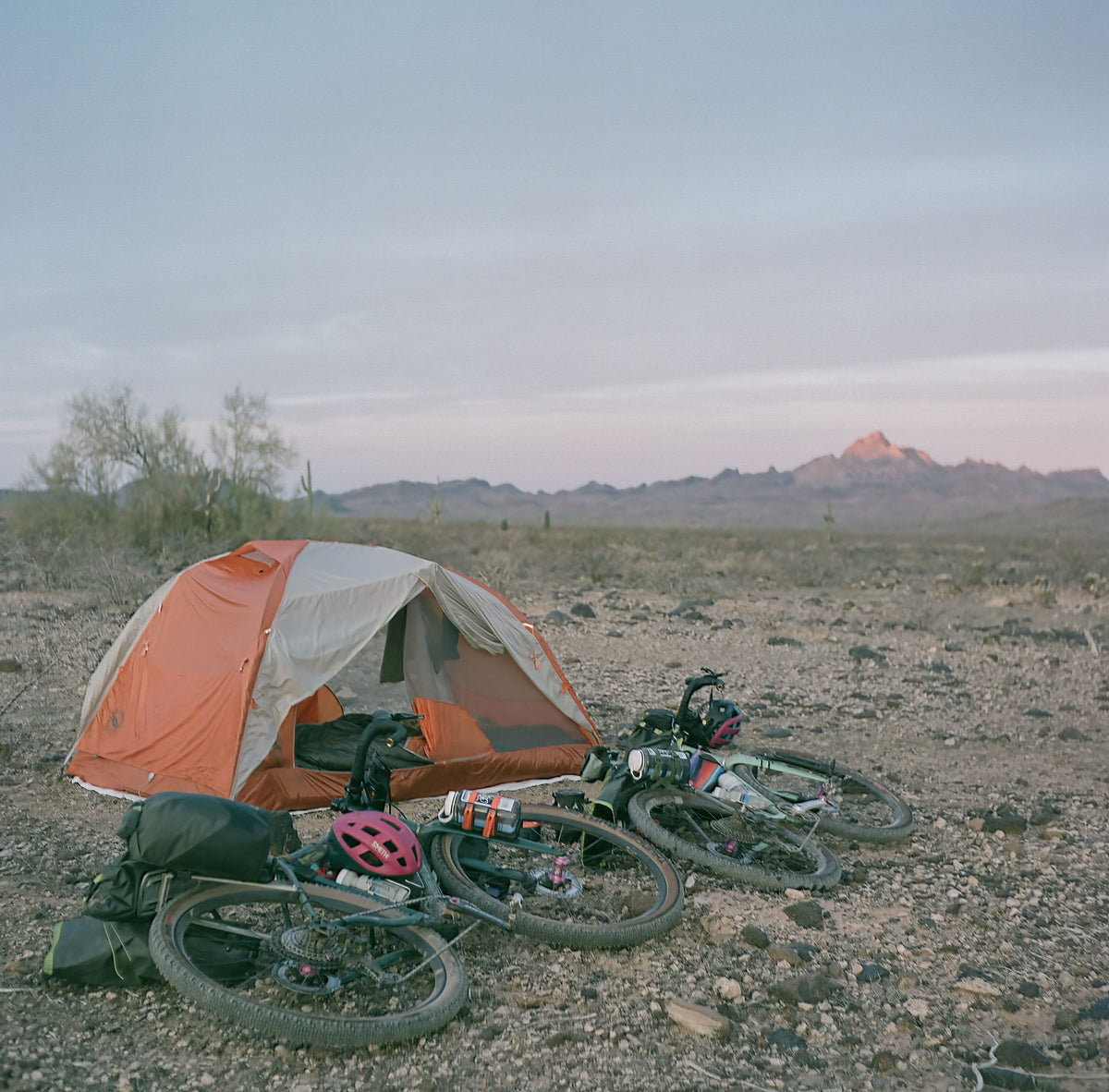
We wanted to enjoy the light show at camp, so we stopped somewhere up on a hillside in the Wilderness. We watched the last few side-by-sides off in the distance, and we once again settled into lands we had all to ourselves. Perfect temperature. Perfect silence. A kind of slow stillness.

Day 3 (42.18 miles)
We woke up right before sunrise. Erich popped out of the tent with his camera to capture a quite colorful sunrise. I could hear the disappointment in his voice about his timing and the colors while I rolled my bags shut. It was a cold yet comfortable morning. I wore a light down coat and my fingers had been triggered to their glossy whiteness (my forefingers and middle fingers have become my cool-weather temperature gauges in my middle age).
As I finished packing up, Erich prepared the morning ritual of making us coffee. Warming our hands and the perk of the coffee, we wished we had more donuts from the truck stop in Gila Bend. It was our last day of riding, so our bags were nearly empty and light, yet our minds were filled with dreams of Mexican food at the finish.


The morning's route was very, very "chonky" as Erich would say. It began on a high point with a slight descent, and we needed to get our speed just perfect to move over the round rocks, ranging from fist size to baby heads. Erich noticed my skill improving as I sped along the tracks, clipped in and balancing every near fall. It feels so good when you connect with the bike and conquer the terrain. The first signs of daylight appeared on the horizon. I love sunrises. It's a brief moment where I'm reminded I get one more chance at this, and if I had any chance, it would be to ride my bike. Not to be a famous photographer or some travel influencer. To disappear, and exist on my bicycle somewhere far away from the noise.
We'd managed our water supply fairly well and didn't need to take any last-minute escape routes to fill up. That in itself feels like an accomplishment to any traveler in the desert. We eventually left the Wilderness and hit smooth and empty tarmac for about 15 miles through vast and open farmlands. Plots of orange and green.

We saw a new cement flood control channel to the left of us, and I took some photos of Erich turning it into a half pipe. Some shared laughter at the ridiculousness of it all. I turned down the invite to try it from fear I wouldn't get up the other side - no need for any accidents on the final day.
We took a left at a road that led us to the trailhead of Margies Peak and the North Maricopa Mountains Wilderness. This was the last section of the route before returning to where we'd began our trip.
A slight climb led us to a gravel road to the north of the wilderness. It seemed to be a hot spot for target practice. We made our way through that stretch of about 5 miles as fast as we could. Without stopping. Again, a reminder that wild animals and creatures are the least threat. It's the rogue bullet from an unpredictable human.


As we began to go south on the road...well, what was once a road was now rutted double tracks in the sand. We challenged our strength and skills the first few times to see if we could surf through the soft sand, but finally gave up and created our own tracks to the side of the road. I absolutely love these opportunities because I become so engaged with the environment. Noting the bushes, the trees, and the mountains. If I'm not following the road, I need to make sure I'm on my way to where I want to go.
We noticed the light and estimated how much longer until dark. We had enough time to share my camera with Erich, and I taught him how to make his first double exposure on film. I have quite a few accidents, but it's a little more exciting when you've planned the composition and done the math correctly for the exposure.
After the rutted roads and reroute, we followed the last ten or so miles on terrain that we had left behind three days before. We recognized the mountains, the saguaro, teddy bear cholla, prickly pear, and even the faint call of the coyotes off in the hills before us. There was a joy within the sense of completion, but a melancholy that began to appear with twilight hour. Did this really have to end…