Type 3 fun in the Gifford Pinchot
Sometimes things don’t turn out according to plan. Oftentimes that can be a bad thing, other times, that can lead to unforgettable spontaneous experiences. Or it could possibly lead to hours of torture. This turned out to be all of the above.
Over the years I have heard legends of Juniper Ridge and the Dark Divide, unmatched views, burly descents, and brutal hike-a-bike. So when Portland traffic held me back on meeting up with some friends in the Gifford, I took the opportunity to give Juniper Ridge a go with my fellow adventurer, Matt.
The day started after missing the start time on a work party meet. Once I realized that I was too late to join, I headed straight for trailforks to cook up an all-day route of the infamous trails nearby. I put together a lollipop loop with a short shuttle that would check off most of the trails en-route, and give us a tad more descending than climbing. The plan was to drop a car at the bottom of Tongue Mountain trail, then shuttle up to the northern trailhead of Juniper ridge. From the trailhead we planned to head south on Juniper Ridge until it connects with Dark Meadow. Then take Dark Meadow down to NF23, and pedal the road back to Sunrise Peak. Finishing with a long descent from Juniper Peak down to the car.


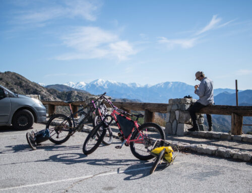
The first Hiccup came in the form of a washout on NF2801 about a mile shy of the Tongue Mountain trailhead. No big deal we thought, but this would be the first small hiccup of many. We dropped a car at the washout, applied copious amounts of sunscreen and headed up to the trailhead. Road 2904 was littered with large waterbars, which looked to be for drainage purposes, but presented Matt’s Subaru Outback with some serious opportunities for bottoming out. After smashing the trailer hitch into waterbeds for four miles, we arrived at the trailhead, excited to start our adventure.
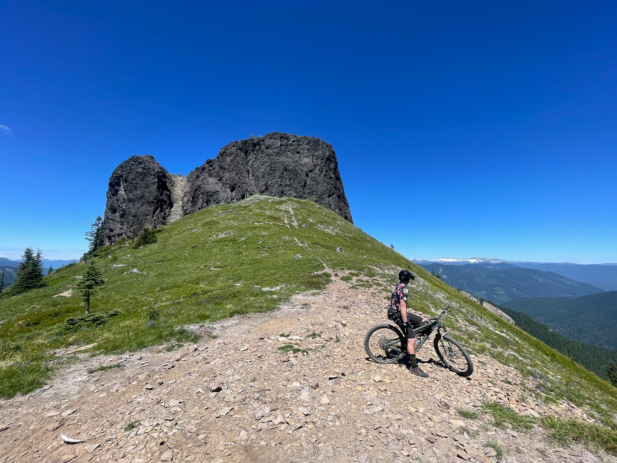
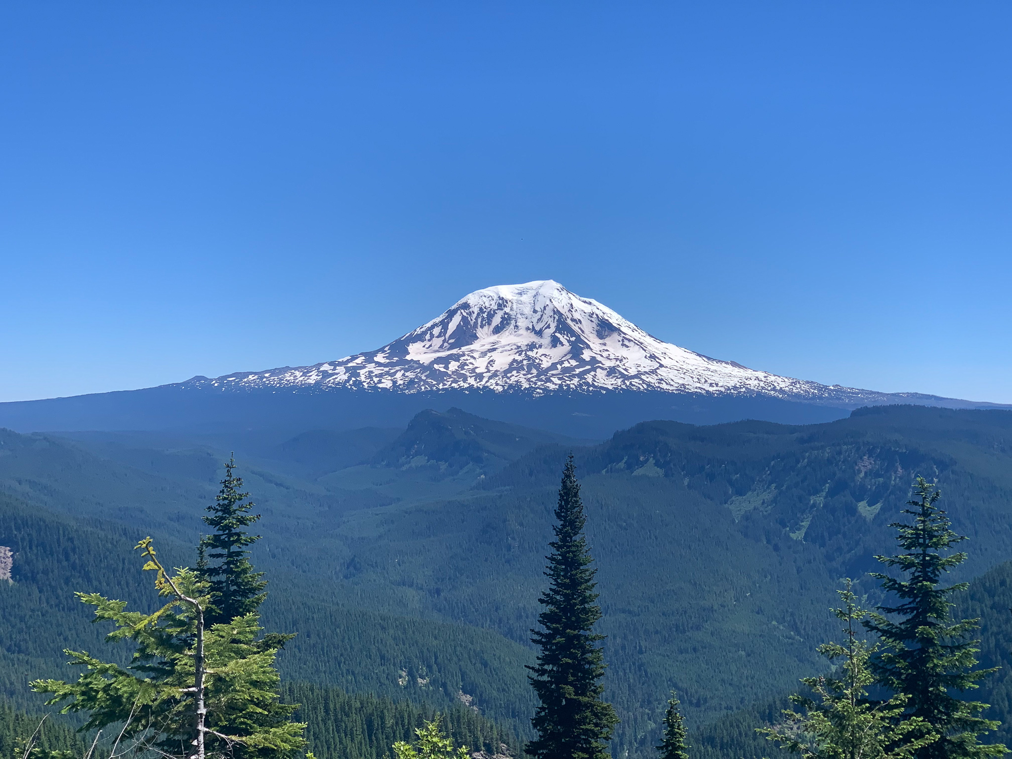
Juniper Ridge from the north starts out with a bang. Granny gear from the first few yards all the way to the summit of Juniper Peak. The first climb is punchy, but manageable, and the infamous moto ruts weren’t too much of a challenge. We took turns pushing ourselves up the steep sections, pushing our heartrate way past the sustainable limits and laughing it off. Not knowing what challenges lie ahead, and how much reserve power we’d need to save. The trail teases epic views a handful of times on the way up to the ridge, but at the top the views slap you right across the face. Bam! Klickitat right in front of you in all it’s glory. And the views don’t stop. All along the ridge you catch more views. From the epic line of cascade stratovolcanoes (Tahoma, Klickitat, Loowit and Wyeast) to the smaller rocky peaks along the route (Goat Rocks, Sunrise Peak, Dark Mountain, Jumbo Peak, McCoy Peak and Craggy Peak). With views like this it would be hard to complain. Except for the Hike-a-bike.
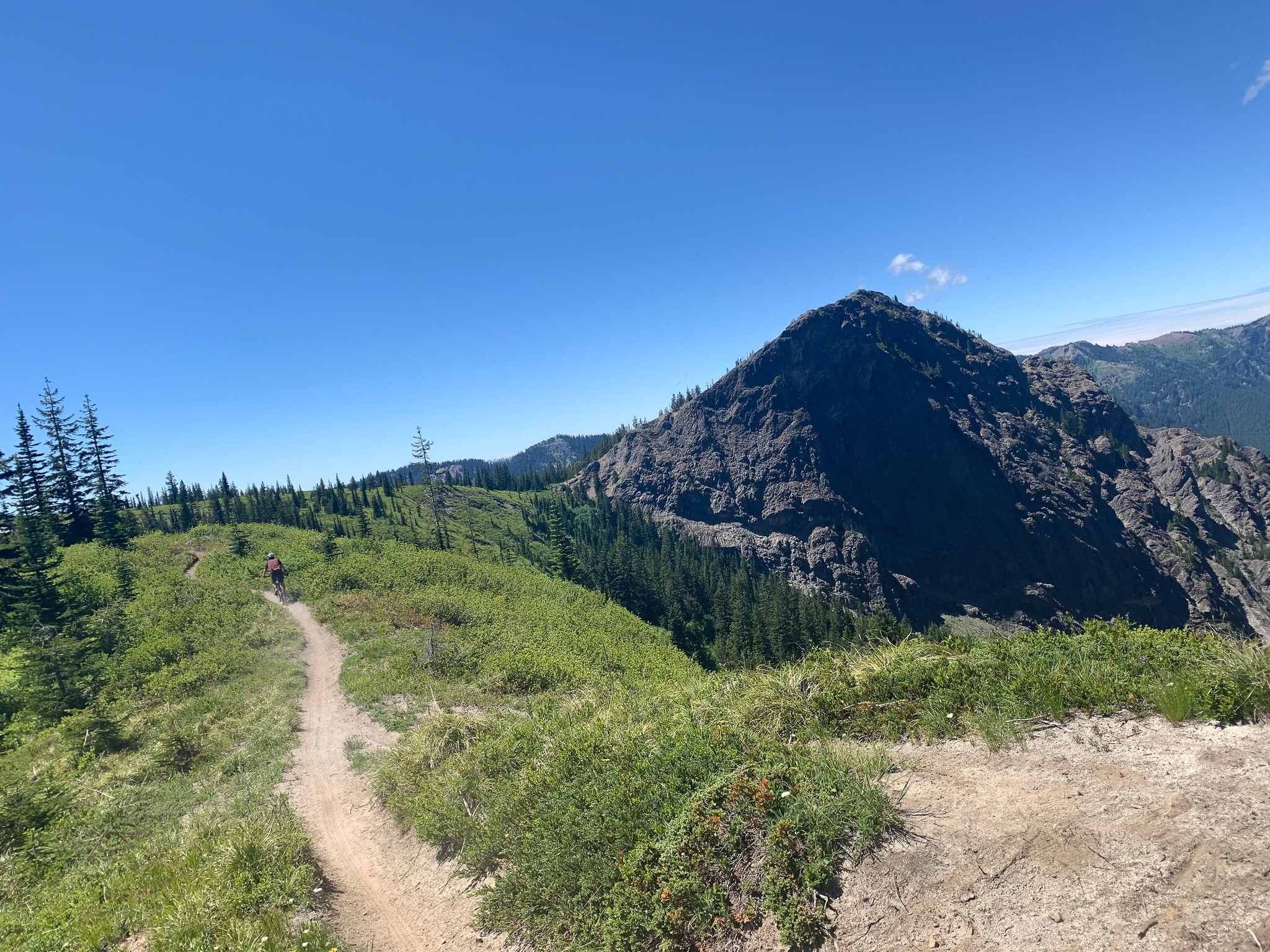
The trail might be manageable to pedal if the trail surface wasn’t littered with loose shale and cavernous Moto ruts. The ruts are so deep that they literally prevent you from pedalling. You can try, but even with 165mm cranks, you’re still hitting your pedals on the side of the ruts. I, unfortunately, thought it was a good day to rock cleats which turned out to be an epic catastrophe (more on that later). After a hearty amount of hiking, you pop out beside Jumbo Peak. This is where things get good. The descent from Jumbo Peak to the bottom of Dark Meadow is obviously the reason people ride this trail. It starts out at the foot of Jumbo Peak, with Klickitat watching over your left shoulder. You descend on the ridge over dusty alpine soil covered in loose rock. The trail is wide enough at the top so you can feel planted enough to play around. As you traverse the ridge, you drop in through wildflowers and heather shrubs, plenty of large roots and rocks allow you to find some natural trail gaps. The motos have helped create just enough bank in the corners to maintain your speed, but watch out for the ruts on the low side. After a few short minutes of bliss, you come to a fork in the trail where Dark Meadow starts.


Dark Meadow descent is the highlight of the route. It is steep and rowdy. It starts out on a few fairly smooth straights with scattered roots and rocks. Then as things get steeper, the ruts get deeper, and the rocks get bigger. Small stumps on the outside of the obvious lines allow you to boost across the rocks and back into the trail utilising the ruts as a small transition to keep your speed up. Be careful getting too wild as the downslope is rather steep and littered with rocks and sticks if you go down. There are a couple really tight switchbacks before the pitch transitions back into a shallower pitch with some loamy flow. we would call it a trail of Semi-flow-tech-gnar. We stopped to cut out some deadfall toward the end of our descent, but overall, the trail could use a good cleanup.
At the bottom, you have to cross a Dark Creek and East Canyon Creek. Dark Creek was easy to navigate. On East Canyon Creek, we decided to go low risk and take our shoes off. The frigid water felt great on the feet. We used the opportunity for our lunch break, and broke out the filter to replenish our water reserves and hydrate for the climb ahead.
The route back up to sunrise peak is a big 2800’ climb. Luckily for us, this was all on a beautiful gravel road free of waterbars and Moto ruts. While the climb was long, it was quite pleasant compared to pushing up ruts while fighting off horseflies. It took us about an hour to get up to the Sunrise Peak trailhead. After a short break we headed onto the trail. Which lasted only about 100 yards before we were pushing our bikes once again.
The Sunrise Peak trail is narrow, steep, and it’s one big rut. Unless you are a unnatural freak of nature, there’s 0% chance that you’re pedalling up this thing. It’s honestly even a pain to walk up. It is so skinny that you are either wheeling the bike up in front of you balancing it on the rear wheel, or you’re walking on the edge beside the trail. Both options are pretty miserable, so it is best to simply look at the view and try to forget about it. At the top we ditched our bikes to hike up to the summit. A short little scramble to the summit of Sunrise Peak leads to an uninterrupted 360º view of the majestic Gifford and the cascades. We took a short breather, but at this point it was close to 6pm and we still had 15 miles to go, so we ate quick and pushed down to the bikes.
The ridge has two high points, which meant we had to push, then descend, then push up again to get to the final descent. We survived the first push and got ready for the rowdiest section of descending. It all started out great. Surfing the big ruts, trying to keep the front wheel straight while navigating the rocks and holes in the trench. After a big rutted corner, I made a move to get out of the rut to try and avoid some oncoming rocks. The soil on the side of the rut had different plans, and just when I needed grip and support out of the front tire it gave out from under me. I went OTB off the side of the trail making impact with two rocks on my lower leg while sandwiching my knee between my bars and the frame. Luckily Matt was there to help me out, but my mind went to worry mode as I felt piercing pain from my knee. We were still about 13 miles from the trailhead and I was hobbling to get back onto my bike. We had another big climb (aka hike) and a very long descent ahead. I took a minute to breathe and get my head on straight before pushing on. The remainder of that descent my legs were shaking and I was way off my game. I had to dismount on a few tricky bits to hobble down. We made it to the bottom in one piece and I had a short breather before beginning the climb back up to Juniper Peak.


The hike was long, and my leg was on fire. I was moving slow and could tell I was holding up Matt, who was looking a little worried about the time. It was 730 and we weren’t even on the final descent. I pushed through the pain and made it up to Juniper Peak. We took a couple pictures and chugged some water before heading down. In my head I was getting worried for another hairy descent like the one I just ate shit on. To my surprise the final descent from Juniper Peak to the trailhead was blissful. The ruts disappeared and the flow began. Sweeping corners mixed with some wide open sections littered with rooty side hits. I started to forget about the crash but each time I went to get playful it reminded me to keep it at 50%. We made it to the shuttle car with big smiles on our faces. It was just passed 8pm, and riding off the bliss of the final Juniper descent we made the decision to keep to the plan and descend Tongue Mountain to the first car. We thought it would be more of the same smooth flow trail we just experienced. We were wrong.
The Tongue Mountain trail starts as a short pedal out to the ridge, then quickly plummets down. Which would be amazing if it wasn’t for the EPIC ruts. I thought they couldn’t get bigger than the ones on Juniper, but again, I was wrong. Added to which, motos have added pavers in the steep spots to help lessen their damage on the trail bed, but some of the pavers have gotten loose and now protrude straight up begging to eat your wheel. Navigating these ruts was tiring. We were already long out of gas, and my leg wasn’t helping. I kept telling myself that I might have enjoyed the trail had I not been injured and exhausted. Tongue Mountain ended up taking longer than expected, but we made it to the bottom without any additional injuries. Our final pedal along Forest Road 2801 (the washout) gave us some time to reflect about the 12 hours of suffering we just endured.
Back at the car we loaded the bikes and I hobbled around to unload some well deserved cold beverages and snacks. By the time we retrieved the shuttle car it was 9:30 PM. With a bum knee and another 90 mins to camp, I decided that it was the safe move to bail on the weekend campout and get home to make sure the leg damage wasn’t anything serious. Quite the learning experience in the Gifford!


Our route traveled through the gorgeous and expansive Gifford Pinchot National Forest. This land was home to multiple indegenous tribes including:
Another epic human powered bike adventure. We gained lots of knowledge for when it comes to trying to plan routes on multi-use moto trails.
If I were to do it again I would:
Start at Sunrise Peak Trailhead, push up to Sunrise Peak for the view, ride to Jumbo Peak, Descend Juniper to Dark Meadow, Pedal up to the car.
This would take most of the good and condense it with the least amount of terrible. Skip the Sunrise Peak trail if you’re trying to just descend or have already seen the views.

Leave A Comment